Alert #15 on Tropical Depression Nine issued by The Bahamas Department of Meteorology, Sunday September 28th, 2025, at 12pm EDT.
BAHAMAS DEPARTMENT OF METEOROLOGY
FORECAST OFFICE SECTION TELEPHONE No. 702-5250/1
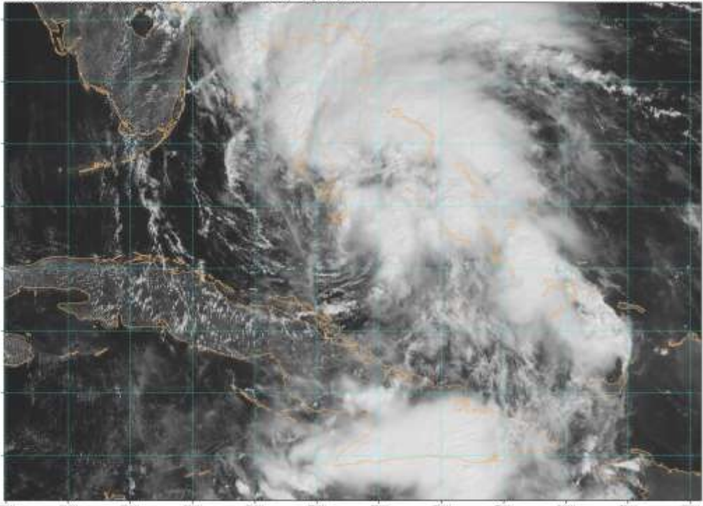
…Depression now slowly moving northward… …Heavy rains continue over the Northwest and Central Bahamas with winds soon increasing later today…
A Tropical Storm Warning remains in effect for the islands of the Northwest and Central Bahamas. This includes the islands of Eleuthera, New Providence, Abaco, Andros, Berry Islands, Grand Bahama, San Salvador, Rum Cay, Long Island, Exuma and its Cays and Cat Island.
A Tropical Storm Warning means that Tropical Storm Conditions are expected somewhere within the warning area within 36 hours.
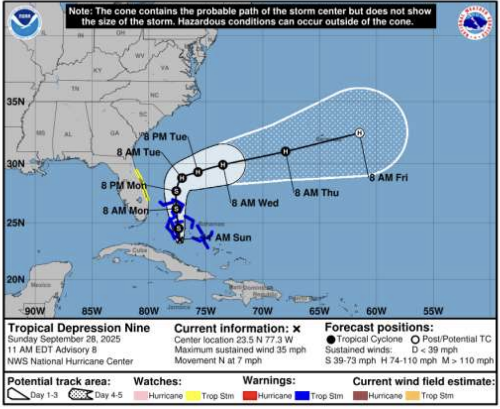
At 11 am EDT, the center of Tropical Depression Nine was located near latitude 23.5 degrees north and longitude 77.3 degrees west, or about 40 miles south-southeast of Kemp’s Bay Andros, 160 miles south of South Abaco and 100 miles south of New Providence.
The depression is moving toward the north near 7 miles-per-hour. A faster motion to the north-northwest or north is expected later today and continuing through Monday. On the forecast track, the center of the system is expected to move across the Central and Northwest Bahamas later today and tonight, and will exit The Bahamas on Monday. The center of the system is now forecast to pass to the east of Andros and over New Providence today and between Abaco and East Grand Bahama tonight and early Monday as a Tropical Storm.
Maximum sustained winds remain near 35 miles-per-hour with higher gusts. Strengthening is expected during the next few days, and the system is forecast to become a Tropical Storm later today and a hurricane by late Monday or Tuesday
Moderate to heavy rainfall is now being experienced throughout the Central and Northwest Bahamas, and is expected to continue today and tonight. Tropical Storm force winds are expected over the Northwest and parts of the Central Bahamas later today and tonight as the depression continues to strengthen.
Rainfall amounts in the Northwest and Central Bahamas are anticipated to be between 4 to 8 inches with isolated amounts up to 10 inches. Residents in low-lying areas should take actions to mitigate property damages due to flooding.
Storm surge will raise water levels 1 to 3 feet above normal tide along the coast of Abaco, the north and east coasts of Grand Bahama, and all nearby cays later today and tonight.
The next Alert on Tropical Depression Nine will be issued at 3 pm EDT.
Issued by: BAHAMAS DEPARTMENT OF METEOROLOGY