Alert #15 on Hurricane Erin issued by The Bahamas Department of Meteorology, Monday August 18th, 2025, at 12 pm EDT.
Alert #15 on Hurricane Erin issued by The Bahamas Department of Meteorology, Monday August 18th, 2025, at 12 pm EDT.
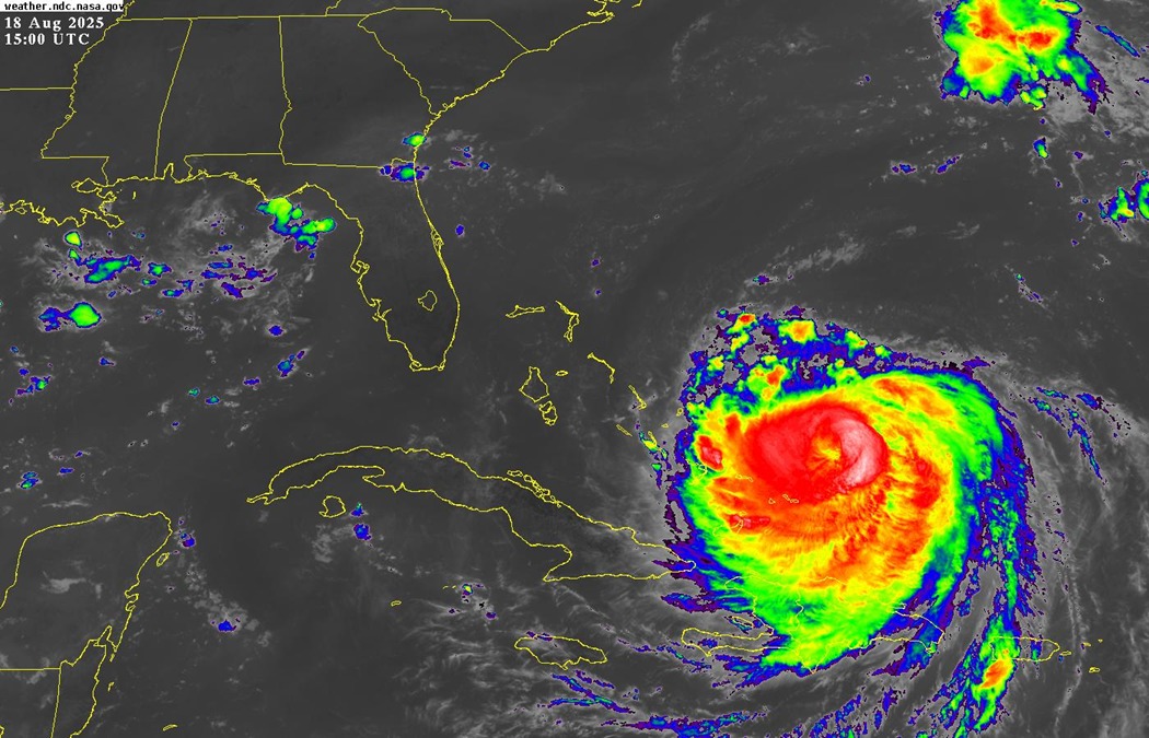
…Erin strengthens and is expected to grow even larger…
…Life-threatening surf and rip currents will occur throughout Atlantic exposed shorelines…
A Tropical Storm Warning remains in effect for the Southeast Bahamas and the Turks and Caicos Islands. This includes the islands of Inagua, Mayaguana, Acklins, Crooked Island, Samana Cay, Long Cay and the Turks and Caicos Islands.
A Tropical Storm Warning means that Tropical Storm conditions are expected somewhere within the above mentioned islands.
A Tropical Storm Watch is in effect for portions of the Central Bahamas. This includes the islands of Long Island, Cat Island, Rum Cay and San Salvador.
A Tropical Storm Watch Means that Tropical Storm conditions are possible in the mentioned islands within 24 hours.
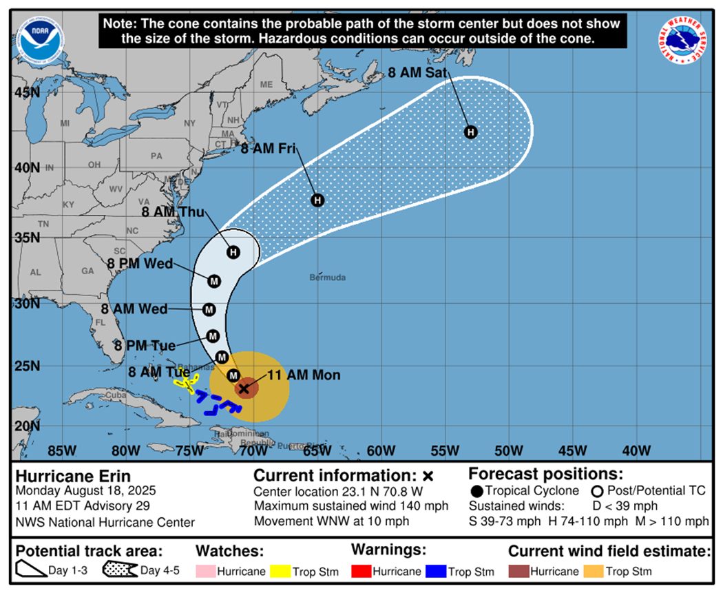
At 11am EDT, the center of Hurricane Erin was located near latitude 23.1 degrees north and longitude 70.8 degrees west, or about 110 miles North of Grand Turk, Turks and Caicos Islands, 173 miles East of Spring Point, Acklins, 200 miles Southeast of San Salvador and 369 miles Southeast of New Providence.
Hurricane Erin is moving toward the west-northwest near 10 miles-per-hour. A turn to the northwest is expected later today. Erin continues to pass to the east of the Bahama Islands today and is expected to move between Bermuda and the east coast of the United States by the middle of the week.
Maximum sustained winds have increased 140 miles-per-hour with higher gusts. Erin is a Category 4 hurricane on the Saffir-Simpson Hurricane Wind Scale. Some additional strengthening is expected today. Erin will remain a dangerous major hurricane through the middle of this week.
Hurricane-force winds extend outward up to 80 miles from the center and tropical Storm force winds extend outward up to 230 miles from the center.
Residents in the Southeast Bahamas and the Turks and Caicos Islands are now experiencing Tropical Storm conditions as the outer bands from Erin pass over these islands. These conditions will continue through the day and begin subsiding tonight. Residents in the Central Bahamas, especially Long Island, Cat Island, Rum Cay and San Salvador could possibly begin to experience similar conditions by tonight or tomorrow morning. These conditions are showers and thunderstorms inclusive of strong gusty winds to tropical storm strength (up to 35 knots/40 mph), heavy rainfall, tornadic activity and hail.
Rainfall amounts of 2 to 4 inches with isolated amounts of 6 inches are expected from the outer bands of Erin that will affect the Turks and Caicos Islands and Central and Southeast Bahamas.
Dangerous swells generated by Erin are now affecting the Turks and Caicos Islands and the Southeast Bahamas and will spread into the Central and Northwest Bahamas today and tomorrow. Mariners should remain in ports until the end of the week as the seas could become extremely rough and dangerous during the swells.
The next Alert on Hurricane Erin will be issued at 3 pm EDT.
Issued by: ANASTASHIA FERNANDER